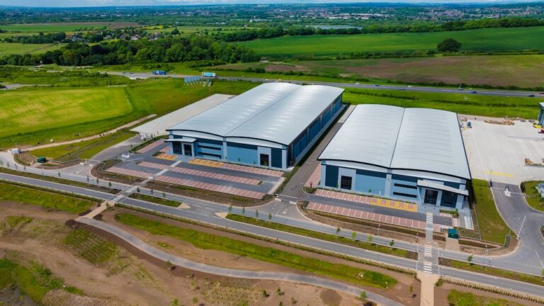
Capturing drone photography and mapping data for a highways project can be a challenging task, particularly when the project spans over three years. Our team was tasked with capturing high-quality aerial images, ground based images and mapping data for a highways project in Coventry. This project required us to overcome several challenges, including weather monitoring, air traffic control requirements, and more.
Weather monitoring was one of the primary challenges we faced during the project. Weather conditions can significantly impact the quality of the aerial images and mapping data captured by drones. High winds, rain, and snow can make it difficult to fly drones safely, while fog and low visibility can impact the accuracy of the data captured. To overcome this challenge, we developed a robust weather monitoring system that allowed us to track weather conditions in real-time. This helped us plan our flights better and capture data when weather conditions were optimal.
Another challenge we faced was complying with air traffic control requirements. There was a lot of aerial activity around this project. Drones we operate in controlled airspace and are subject to strict regulations regarding their use near airports and other aviation facilities. We worked closely with air traffic control authorities to ensure that our drone flights complied with all regulations and were conducted safely. This involved obtaining permits, communicating with air traffic controllers, and adhering to strict flight plans and procedures on a monthly basis.
One of the key strategies we used to overcome these challenges was to employ the latest drone technology and software. Our drones were equipped with advanced sensors and cameras that allowed us to capture high-quality images and data even in challenging weather conditions. We also used sophisticated software tools that helped us plan our flights, analyze data, and visualize the results. This helped us optimize our workflows and improve the accuracy and efficiency of our data capture.
Only on one occasion, in 3 years did we have to revisit site due to poor weather.
Despite these challenges, our team successfully captured exceptional drone photography and mapping data for the highways project over the three-year period. By using the latest technology, working closely with air traffic control authorities, and implementing a robust weather monitoring system, we were able to overcome all the challenges and deliver excellent results for our clients.
A big thank you to both the councils and clients we’ve work with on this project.