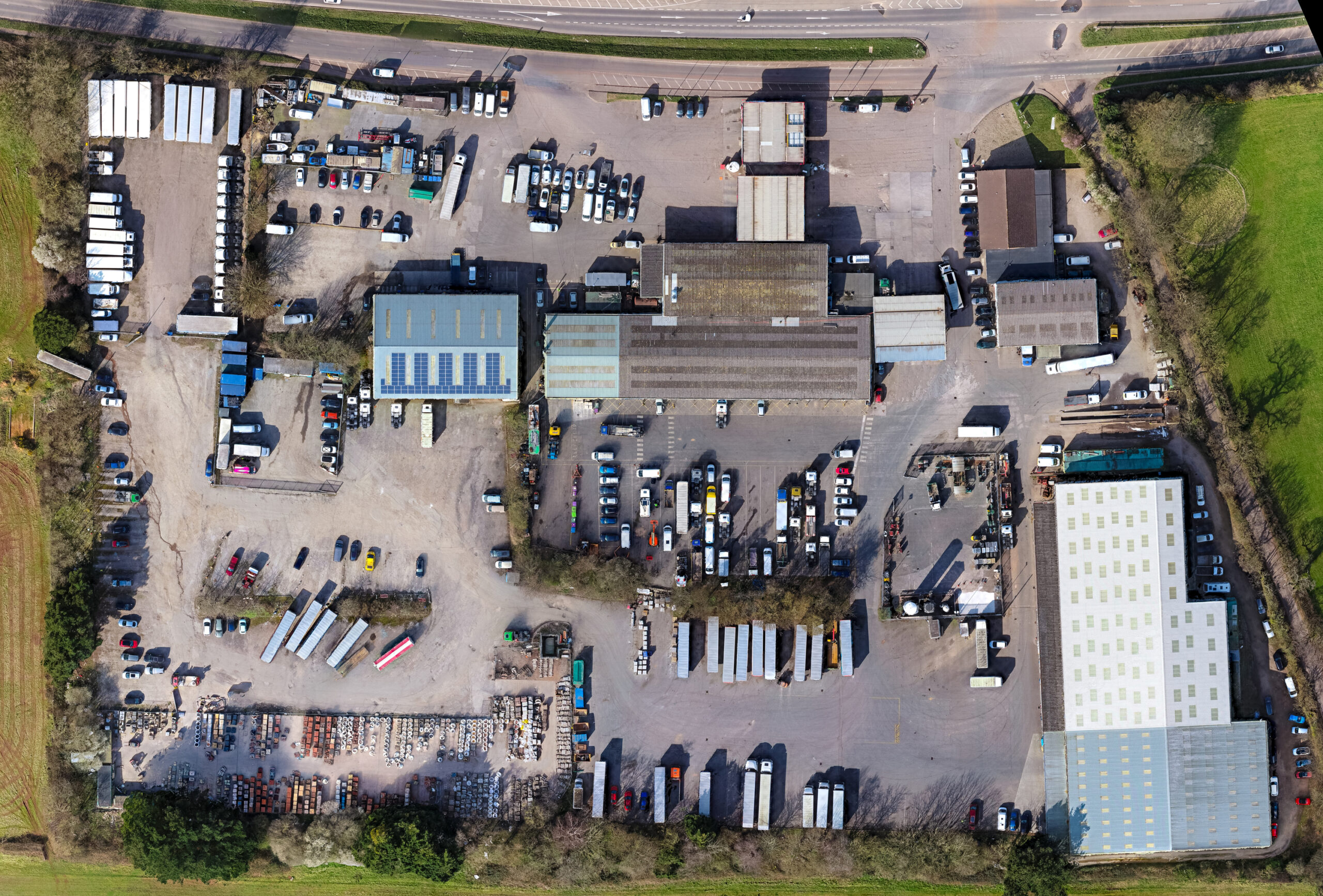
Provides a clear, comprehensive bird’s-eye view of the entire site layout,
enabling future tenants and clients to instantly understand its scale and location.
Drone mapping is no longer a nice-to-have — it’s a must-have.
Whether you’re managing a logistics park, building distribution centres, or opening up new industrial plots, aerial mapping brings the clarity and control modern developments demand.
To see how this works in action, or to request a free site assessment, get in touch with our team today.
What Makes This Different from Standard Photography? In the UK, drones are legally restricted to a maximum flight altitude of 400ft. As a result, capturing large sites—typically more than a few acres—in a single photograph leads to significant distortion. Our advanced aerial mapping techniques overcome this limitation by capturing multiple high-resolution images and seamlessly stitching them together to create a single, cohesive satellite-style overview.
What’s the Resolution Like? Exceptionally high. Details such as kerb lines, road markings, and surface textures remain sharp and visible even at full resolution.
How Is It Achieved? We use state-of-the-art plan view technology to capture thousands of overlapping images from above. These are then processed and merged into one fully-stitched, high-detail image of your entire site.
What Are the Uses? Ideal for marketing materials, project planning, progress tracking, stakeholder reporting, and more.
Tailored to Your Project Every site is unique. If you’d like to explore how our drone mapping solutions can support your project, we’d be happy to discuss your requirements. Please get in touch below.